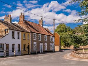
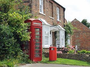
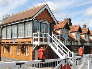
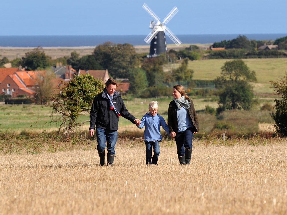
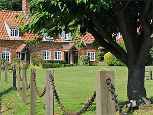
The wooden bridge and village sign at South Creake.

Villages in West Norfolk

Steeped in history and charm the villages of west Norfolk are quiet places of solitude with walking routes, welcoming pubs, and atmosphere’s that will make you want to stay here forever. Cosy up in a local pub in the winter or enjoy a refreshing drink in the sunshine in summer.

Villages

Steeped in history and charm the villages of west Norfolk are quiet places of solitude with walking routes, welcoming pubs, and atmosphere’s that will make you want to stay here forever. Cosy up in a local pub in the winter or enjoy a refreshing drink in the sunshine in summer. The villages of west Norfolk are listed below but not all have facilities or walking routes.

Coastal

Brancaster

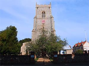
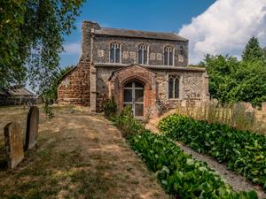
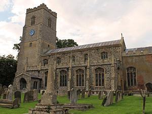
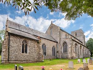
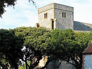
The village with the church of St Mary The Virgin at its centre is surrounded by stunning coastline. It is a popular stopping point for exploring the Norfolk Coast Path.

Brancaster Staithe

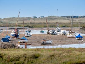
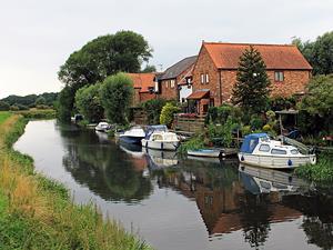
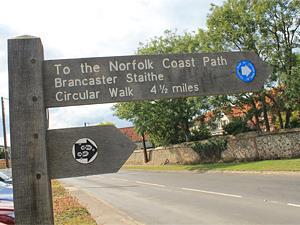
Now a popular sailing centre surrounded by atmospheric coastline, Brancaster Staithe was once a Roman town and thriving port, exporting corn from the local hinterland.

Burnham Deepdale

Burnham Deepdale is in the parish of Brancaster, together with Brancaster Staithe and Brancaster itself. The three villages form a more or less continuous settlement along the coast road adjacent to beautiful coastal marshes and beaches.

Burnham Overy Staithe

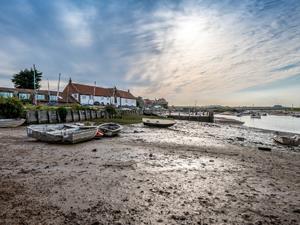
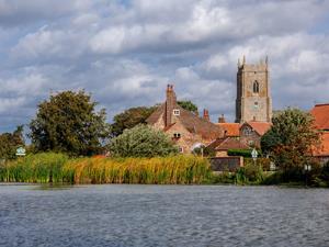
Burnham Overy is made up of two settlements, Burnham Overy Town the original village adjacent to the parish church and Burnham Overy Staithe, a rather larger settlement about 1 mile away and next to the creek-side harbour.

Heacham

There is evidence of settlement in the Heacham area, for around the last 5,000 years, with numerous Neolithic and bronze age finds.

Holme-next-the-Sea

The pretty little village of Holme-next-the-Sea is in the stunning Norfolk Coast Area of Outstanding Natural Beauty.

Old Hunstanton Village

Old Hunstanton is a village settlement adjacent to the larger resort of Hunstanton or New Hunstanton. The quiet character of Old Hunstanton remains distinct from and complements that of its busy sibling.

Ringstead

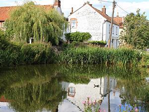
Ringsted (Great Ringsted) is a small village situated just 3 miles inland from Hunstanton. The village offers an excellent village store, the Gin Trap Inn and is close to Ringsted Downs, a large area of chalk grasslands.

Sedgeford

Sedgeford is situated about 3 miles south east of Hunstanton and is located in the Norfolk Coast Area of Outstanding Natural beauty.

Snettisham

Snettisham is located 5 miles south of Hunstanton and 10 miles from Kings Lynn. There has been a settlement in Snettisham since ancient times as shown by discoveries of flints from the Mesolithic and Neolithic periods.

Thornham

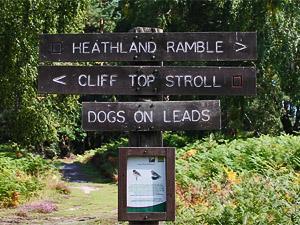
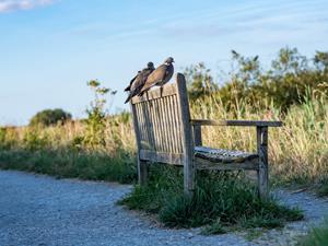
Thornham is a small coastal village about 4 miles east of Hunstanton and is situated in the Norfolk Coast Area of Outstanding Natural Beauty. The village is separated from the sea by atmospheric marshes. The famous RSPB Bird Reserve at Titchwell is just two miles to the east and Holme NWT one mile away to the west.

Titchwell

Titchwell is probably best known as the home of RSPB Titchwell the renowned reserve which includes reed beds, salt marshes and a freshwater lagoon as well as the beach and woodland around the car park and visitor centre. Facilities include three bird hides, a sea watching platform, two nature trails, and the visitor centre.

Countryside

Burnham Thorpe

Around ½ mile inland from Burnham Market, the village of Burnham Thorpe is the birthplace of Horatio Nelson. His father, Edmund Nelson, moved to Burnham Thorpe in 1755, after his marriage.

Castle Acre

The village of Castle Acre lies on the River Nar, 15 miles east of King’s Lynn. It is best known today for the twin ruins of Castle Acre Castle and Castle Acre Priory, which lie immediately to the east and west of the village respectively. Both were founded soon after the Norman Conquest by William de Warenne the first Earl of Surrey.

Castle Rising

The village of Castle Rising, 5 miles north east of King’s Lynn, was mentioned in the Domesday Book of 1066, when it was owned by Odo, Bishop of Bayeux, the half-brother of William the Conqueror. This lovely old village, part of the great Sandringham estate is dominated by the magnificent remains of 12th century Castle Rising. One of the finest and most elaborately decorated castle keeps in Norman England, Castle Rising was begun in 1138 by William ‘Albini and surrounded by 20 acres of elaborate earthwork defences.

Denver

Denver is a charming village about 1 miles south of Downham Market. Situated on the edge of the Fens, the village gently descends on the flat Fens toward Denver Sluice. The church of St Mary sits in a long graveyard at the junction in the old village centre. Also at the heart of the village are the post office and pub, The Bell Inn. The inventor Captain George Mamby, was born in the village in 1765, and a plaque commemorating this can be found at his birthplace.

Dersingham

One of the largest villages in west Norfolk, Dersingham is 9 miles north of King’s Lynn. The village has many local amenities and is served by a Post Office, two supermarkets, florists, a garden centre, garages, a true cobblers, chemist, dentist, opticians, chiropractors, hair and beauty salons, butchers, newsagents, takeaway outlets and soft furnishings outlets. Dersingham is served by two public houses, The Feathers and The Coach & Horses.

Docking

Docking is a pretty village in the north western corner of Norfolk which can trace its origins back to Roman times. It is one of the highest points in the Norfolk. Because of the elevation of the village it had problems for years with the supply of drinking water, and was often known as ‘Dry Docking’. In the 1760s a well was sunk some 230 feet down which provided domestic water for the village at a farthing per bucket. The use of this well continued until 1936 when water was eventually piped into the village.

East and West Rudham

Situated on the A148, connecting King’s Lynn with Fakenham the villages of East Rudham and West Rudham offer a great base to stay of visit in the heart of the West Norfolk countryside. At West Rudham the village green is a focal point around which a pub, The Crown, a tea room, village store and local independent shops can be found. A second pub The Dukes Head is found at West Rudham.

Feltwell

The village has grown from its Saxon beginnings to its present population of around 4000. It is a thriving community with a small primary school originally built as a hospital. The village has two pubs, The Lodge and The West End as well as a small selection of local shops.

Fincham

Fincham is about 10 miles south of King’s Lynn and 5 miles east of Downham Market. Fincham has a relaxed atmosphere with its many old houses. The fine church of St. Martin is of perpendicular style and has an imposing tower. It is mainly a re-building of 1450 but the porch is Victorian. Once the village had two churches not far apart, but the one dedicated to St. Michael fell into decay and was pulled down in 1744.

Gayton

The village of Gayton is 7 miles east of King’s Lynn. It is a thriving village in West Norfolk at the centre of the Gayton Group of Parishes with the smaller village of Gayton Thorpe nearby. There is one pub in the village, The Crown. The village also has two butcher’s shops, a child care/daycare centre, a hair salon, a fish and chip shop and petrol station combining convenience shop/post office. At the heart of the village St Nicholas’ Church, is an impressively large church predominantly of the 14th century although probably on the site of a previous structure.

Great Bircham

Great Bircham sits on the very edge of the Sandringham and Houghton Hall Estates. It is a very attractive village with many traditional Norfolk cottages with a general store/deli and pub The King’s Head at its heart.

Great Massingham

Several large ponds dominate the village, some of which have their origins as the fish ponds for an 11th century Augustinian Abbey. The village is characterised by the flint and cobble cottages which huddle around these ponds. The village’s origins are thought to go back to the 5th century, but today it is still a thriving community with a village shop and post office, and pub The Dabbling Duck.

Grimston

Grimston and its neighbour Pott Row are around 7 miles east of King’s Lynn and just a few miles away from the Royal family’s residence at Sandringham.

Hilgay

The Village of Hilgay is 4 miles south of Downham Market. It sits on a raised isle, around 20 metres above the surrounding fenland, this elevation having become more pronounced as the draining of the fenland has caused the ground to shrink. It was notable in Saxon and early Norman times for the large numbers of fish and eels found in the locality. Hilgay Old Bridge and the newer bridge of the A10 cross the River Wissey at the northern edge of the village.

Hillington

Recorded history starts with the Domesday Book in 1086. At that time, the village was called Helingetuns meaning ‘as lying near the water’. A key landmark in the village is the gatehouse to Hillington Hall. Hillington Hall itself was first erected in 1624 but later pulled down and re-built in 1948.

Ingoldisthorpe

The village of Ingoldisthorpe in 9 miles north of King’s Lynn and 7 miles south of Hunstanton. The village has a post office and an impressive church, St Michael’s, which was almost entirely re-built in the 14th century and then subject to a comprehensive restoration programme in the mid19th century. It is particularly notable for its stunning collection of late 19th and early 20th century glass.

Methwold

The parish of Methwold also includes the hamlets of Methwold Hythe, approximately 1 mile (1.6 km) west of the village and Brookville to the north east. The village is situated on a sloping site on the edge of the chalk land which rises out of the surrounding lowlands of the Fens. The landscape to the east of the village, where the Thetford Forest begins, is totally different to the wide panorama of fenland to the west.

Middleton

Middleton lies on the A47 around 3 miles east of King’s Lynn. The village extends north and south of the main road extending to Fair Green in the northern part of the village and Blackborough End in the southern end of the village. At the centre of the village is the village hall, post office, and pub/restaurant Middleton’s. The Gate Inn is in the Fair Green part of the village. The village church, Saint Mary’s has 14th century foundations, but was mainly restored in the 19th century.

Narborough

Narborough is situated in the Nar Valley, with the river Nar flowing through on its way to the River Great Ouse at King’s Lynn which is around 10 miles away. The village features some impressive buildings including Narborough Hall, set in eighteenth century parkland by the River Nar and Narborough Mill built around 1780.

North Creake

North Creake lies 3 miles south of Burnham Market and about 5 miles from the coast. The village lies on the River Burn which flows through the centre of the village. Most of the agricultural land surrounding the village, and many of the village houses, belong to the estate of the Earl Spencer, who consequently has significant influence on village matters, although his family seat is many miles away in Northamptonshire.

North Runcton

North Runcton is situated about 4 miles south east of King’s Lynn. In the centre of the village is the green and All Saints’ Church. Also on the green is the former school (now the Village Meeting Place, used by a variety of clubs and activities), old post office and a village sign.

North Wootton

North Wootton village is immediately adjacent to King’s Lynn. Former marshland, drained several centuries ago, links the village to the coast and the North Coast Area of Outstanding Natural Beauty. The village is a mixture of traditional carrstone houses and newer developments.

Outwell and Upwell

The villages of Outwell and Upwell lie around 18 miles south west of King’s Lynn and only 5 miles from Wisbech. In the Middle Ages they were collectively known as ‘Welle’ or ‘Welles’, and today they are absolutely continuous, so it is not obvious to a visitor where one ends and the other begins. Together they stretch about 4 miles along the old course of the Nene which is the main navigation link between the River Great Ouse and the River Nene which subsequently connects to the canal network of central England.

Pentney

Pentney is located about 8 miles south east of King’s Lynn. It is in the valley of the River Nar, a tributary of the River Great Ouse. The age of the village is unknown, but it dates at least to the 3rd or 4th centuries, from which time there is evidence of a Romano-British local pottery industry. A Roman road and settlement in Pentney ran close to the river Nar.

Runcton Holme

Runcton Holme lies to the north of Stow Bardolph and to the south of Watlington about 5 miles north of Downham Market. The village Church, St James, which is essentially a Norman church sits in a field above the village street and is constructed of a mixture of flint, red brick and gingerbread car stone.

Shouldham

The village of Shouldham lies about 7 miles north east of Downham Market. The village clusters around the attractive village green, home to the King’s Arms public house, recently re-opened as a community pub. Also in the village, Chalk & Cheese features a gifts and local produce shop along with bar, restaurant and accommodation.

South Creake

South Creake, tucked into the valley of the little river Burn is about 15 miles east of Hunstanton and 6 miles north of Fakenham. Its heart is the Green and playing field beside the river and the B1355 road which runs towards the coast, about 6 miles distant. At the heart of the village is The Ostrich public house, offering accommodation and food.

South Wootton

South Wootton is about 2 miles north east of King’s Lynn town centre, adjacent to North Wootton and about 2 miles south of Castle Rising village. The older part of the village grew up around the village green and St Mary’s Church, though there has been a fair amount of new housing built since the 1960s connecting the village to the main town of King’s Lynn. The village has a large and attractive green and pond. The village is served by a large Village Hall, local fish and chip shop and two pubs, The Swan in the centre of the village and The Farmers , based at Knight’s Hill Hotel which is a little way from the centre of the village.

Stanhoe Village

Stanhoe is a small village around 11 miles east of Hunstanton. In the middle of the village is a large duck pond, otherwise known as the Pit. Many of the houses are built from traditional Norfolk materials of flint, chalk, and brick, roofed with curved red tiles. There are several fine large houses, including Stanhoe Hall. The village has a public house, The Duck Inn, and benefits from a Village Hall with a playing field and play area facilities.

Stoke Ferry

Stoke Ferry lies on the edge of the Fens, about 7 miles south-east of Downham Market. The village lies close to the River Wissey which has also been known as the River Stoke. South east of the village, the River Wissey connect with the Cut off Channel, both of which connect with the River Great Ouse. The village has a long history, and was certainly well established by the time of the Norman Conquest, its population, land ownership and productive resources being extensively detailed in the Domesday Book of 1086.

Stow Bardolph

The Civil Parish of Stow Bardolph comprises three villages: Stow Bardolph, Stow Bridge and Barroway Drove. Stow Bardolph is a small village, around 3 miles north of Downham market and 9 miles south of King’s Lynn. Stow Bridge can be found between Downham Market and King’s Lynn, on the banks of the River Great Ouse. Barroway Drove lies on the eastern edge of The Fens, often referred to a Bardolph Fen.

Stowbridge

Stowbridge is a village in the parish of Stow Bardolph and extends into Wiggenhall St. Mary Magdalen. Stowbridge can be found between Downham Market and King’s Lynn, on the banks of the River Great Ouse. ​​​​​​The village is home to St. Peter’s Church, a Grade II listed building and a Church of England chapel of ease for Stow Bardolph.

Syderstone

The village dates back well over a thousand years. The original Anglo Saxon name was Sidsterne, which is thought to mean “large estate”, from the Old English “sid” meaning broad or extensive and “sterne” meaning property.

Terrington St Clement

Terrington St Clement is a large village situated about 7 miles west of King’s Lynn. Much of the surrounding farm land has been reclaimed from the sea to provide the rich agricultural farmland.

The Walpoles

The Walpoles have a rich history. The area is known to have been settled by the Romans, who built the massive earthen sea wall which is still called Roman Bank. Until the installation of the 1st Sutton Bridge, in 1821, Roman Bank provided the only route from north Norfolk into Lincolnshire. Some say that King John lost his treasure in Walpole, in 1216, whilst journeying from King’s Lynn to Newark.

Tilney All Saints

This attractive village clusters around the church, ‘All saints’, renowned as one of the ‘Marshland Gems’. It is believed to date from the late 12th century dates and features a fine Norman Arcade and splendid double hammer-beam roof. Much of the current exterior relates to 15th and 16th century remodelling.

Tilney St. Lawrence

The village lies just south of the A47 about 7 miles south west of King’s Lynn. The parish actually includes the villages of Tilney St Lawrence and Tilney-Cum-Islington. In fact at the time of Domesday Book, Tilney-Cum-Islington was the larger settlement, but by the late 13th century Tilney St Lawrence had grown to be more dominant. The ruined church of St Mary’s Islington is an atmospheric reminder of former times.

Watlington

Watlington is located 7 miles south of King’s Lynn and 8 miles north of Downham Market. Easily accessible from the A10, it is also served by its railway station on the King’s Lynn to Cambridge and London line.

Welney

The village of Welney is situated 11 miles south west of Downham Market and 6 miles from the small Cambridgeshire town of Littleport. The village is situated immediately to the west of the Ouse Washes and the parallel rivers of the Old Bedford River, River Delph and New Bedford River which are crossed by the A1101 road.

West Acre

The village of West Acre lies 12 miles east of King’s Lynn on the north side of the River Nar in a heavily wooded valley. Close to the village church are the remains of a Priory which was founded for the monks of the Cluniac Order in the 13th century.

West Dereham

West Dereham is situated 4 miles east of Downham Market and 13 miles south of King’s Lynn. Situated on the edge of the Fens, it has a spacious feel and is well located for exploring the Fens and the Brecks.

West Lynn

West Lynn sits on the west bank of the River Great Ouse across from King’s Lynn. A ferry has linked West Lynn to main part of King’s Lynn since 1285 and continues to provide a regular passenger ferry service Monday – Saturday. The ferry provides an ideal way to view the beautiful historic quayside of King’s Lynn as you approach it from the river and is a convenient service for commuters and shoppers who wish to avoid travelling and parking in the town centre. The alternative route by road is about 2 ½ miles.

Wiggenhall St Germans

Wiggenhall St Germans is situated 5 miles south of King’s Lynn and has developed on both east and west sides of the River Great Ouse. The parish includes the hamlets of Wiggenhall St Mary the Virgin and Wiggenhall St Peter. It was the site of Fitton, the ancient seat of the Howard family.

Wiggenhall St Mary Magdalen

Wiggenhall St Mary Magdalen is 8 miles south of King’s Lynn. The village sits beside the west bank of the River Great Ouse. Most of the early settlement appears to have occurred close to the river, possibly due to the presence of a levee along the western side of the River Great Ouse, made of silts deposits by a former watercourse, the Wiggenhall Eau. This is where the splendid parish church of St Mary Magdalen is found. The tower dates from the 13th century although much of the church appears to have been re-built in the 15th century.

Wolferton

The village of Wolferton is situated 7 miles north of King’s Lynn and just 2 miles from Sandringham House. Indeed the village is located within the Sandringham estate and is a special part of West Norfolk.

Plan your visit to west Norfolk

Belle Vue

Accommodation

Whatever the type of accommodation in west Norfolk you are looking for, we have a great deal to offer you – from country house hotels to seafront guesthouses, converted barns to farmhouses – you’ll find a great range of places to stay in the region to suit all tastes and budgets.
Belle Vue

Travel to west Norfolk

west Norfolk is easily accessible from anywhere in the world with fantastic rail links from London and major airports, along with a diverse network of bus routes and roads.
Belle Vue

Tourist Information Centre

Make the most of your stay and visit one of our Tourist Information Centres.